The OfyGA group of the ECOAQUA institute of the University of Las Palmas de Gran Canaria has described for the first time the thresholds of sea surface temperature and chlorophyll concentration that characterize the phytoplankton in the Strait.
These blooms form the basis of the food chain of marine Antarctic ecosystems, and affect the diet of penguins, seals and whales, among other species.
The Bransfield Strait, located between the South Shetland Islands and the Antarctic Peninsula, is a a region of crucial importance that is highly sensitive to climate change. In an effort to better understand this unique marine ecosystem, the Oceanography of Applied Physics (OFyGA) research group of the ECOAQUA university institute of the University of Las Palmas de Gran Canaria (ULPGC) has conducted a study published in the prestigious journal Ocean Science, one of the most important scientific journals for understanding the state and behavior of the ocean.
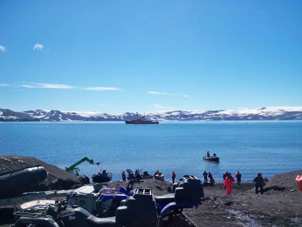
 Spanish Antarctic base Gabriel de Castilla and BIO Hespérides (in the background) on Deception Island, Antarctica. Author: Borja Aguiar
For the first time, the study identifies critical thresholds of sea surface temperature and chlorophyll concentrations that can describe monthly phytoplankton blooms in the Bransfield Strait.
These findings will be essential for understanding the temporal evolution of these blooms in the coming years, providing an invaluable tool to monitor changes in this marine ecosystem.
The results of this study by the OFyGA group represent a significant advance in the understanding of biological and ecological processes in this strait, which has been designated as an Antarctic Specially Protected Area, and underscore the importance of conducting continued scientific research at the site to address the environmental challenges facing polar regions.

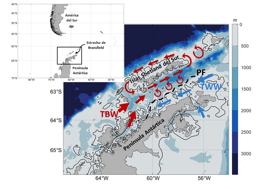
Schematic of the circulation in the Bransfield Strait. Abbreviations for some of the main oceanographic features are as follows: PF (Peninsula Front), TBW (Transitional Zonal Water with Bellingshausen influence) and TWW (Transitional Zonal Water with Weddell Sea influence). The solid black line represents a depth of 200 metres.
This is especially important because phytoplankton is the base of the food chain in Antarctic marine ecosystems, and its dynamics have a direct impact on other trophic links, such as zooplankton (including krill), which are essential for feeding species such as whales, penguins, seals, sea lions, squid, birds or fish. Therefore, knowledge of sea surface temperature and chlorophyll concentrations thresholds will allow scientists to accurately monitor phytoplankton dynamics and thus trophic relationships in the Bransfield Strait using satellite data.
This line of research is part of the doctoral thesis of the researcher Marta Veny, who is doing the PhD program in Oceanography and Global Change (DOYCAG) at the University of Las Palmas de Gran Canaria (ULPGC), under the direction of Borja Aguiar and Ángeles Marrero.
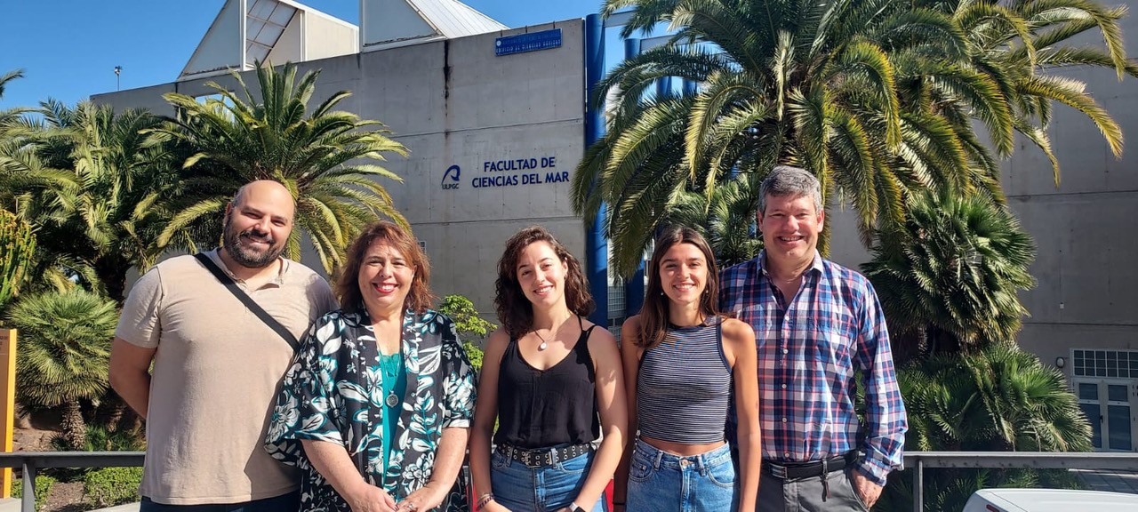
 Photo of the OFyGA group in front of the Basic Sciences building of the ULPGC. From left to right: Borja Aguiar, Ángeles Marrero, Tania Pereira, Marta Veny and Ángel Rodríguez.
Veny explains that “a change in the predominant groups of Antarctic zooplankton leads, in turn, to an effect at higher trophic levels, ultimately damaging the diet and populations of large organisms, hence the importance of its control. ” “Antarctic marine ecosystems are highly dependent on the seasonal cycle of the interaction of the atmosphere with the oceans and the associated sea ice dynamics,” she adds, which would be affected by the change in sea surface temperature, among other factors.
In the process of the work, the seasonal cycle of phytoplankton blooms in Bransfield Strait was investigated by analyzing 21 years of satellite data of chlorophyll (an indicator of phytoplankton) and sea surface temperature (1998-2018).

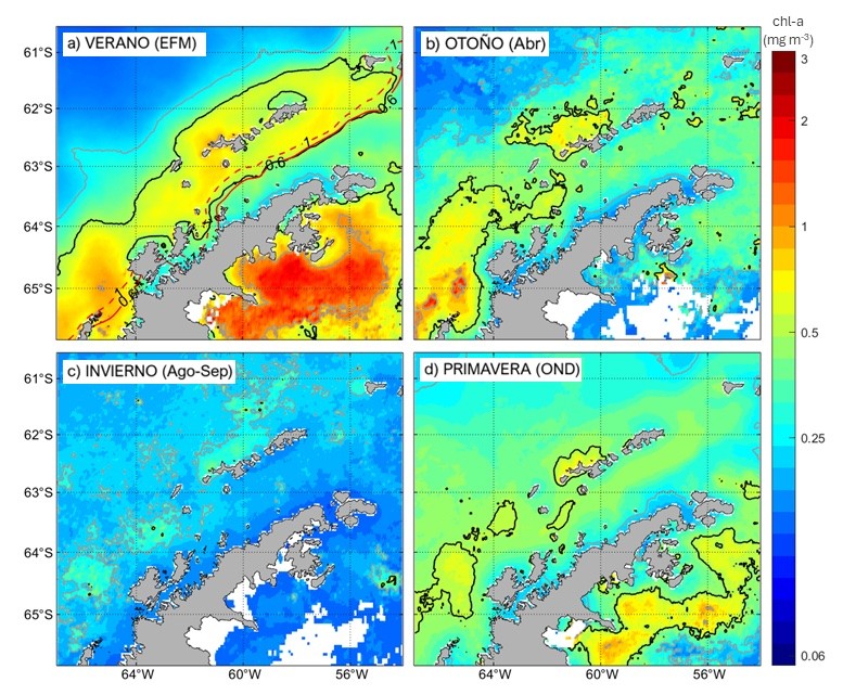
Seasonal chlorophyll maps for summer, fall, winter and spring. Climatologies are averages from January 1998 to December 2018. Solid black lines indicate chlorophyll concentrations of 0.5 mg/m3, while solid gray lines represent concentrations of 0.25 mg/m3 and 1 mg/m3. Solid and dashed red lines represent summer isotherms (zones of equal temperature) of 0.6 oC and 1 oC, respectively.
Although the study focuses on a polar region, the proposal to use satellite observations of temperature and chlorophyll for the study of phytoplankton blooms is an oceanographic tool of proven application in other regions of the planet and, therefore, of potential application to the case of the Canary Islands region with the particularities of the local biological communities.
Marta Veny, who has a degree in Marine Sciences and a master's degree in Oceanography, emphasizes the fundamental role that phytoplankton play in marine ecosystems and in economic activities such as fishing and tourism.
In the first case, that of fishing, because as the base of the trophic chain, it influences the abundance and distribution of fish. And, secondly, because the presence of marine biodiversity and water quality also affects the attraction of a tourist profile that seeks diving destinations, marine life observation and sea-related activities. Hence the “importance of knowing the spatiotemporal variation of the blooms in any region, such as the Canary Archipelago, because of the direct impact it has on the efficient management of marine resources”.
Together with Marta Veny, the directors of her thesis, Borja Aguiar and Ángeles Marrero, as well as Tania Pereira and Ángel Rodríguez, all members of the OFyGA group of the ULPGC, have collaborated in the publication of this article and in her research.


